|
|
|
|
Click to Enlarge
|
|
|
|
Click to Enlarge
|
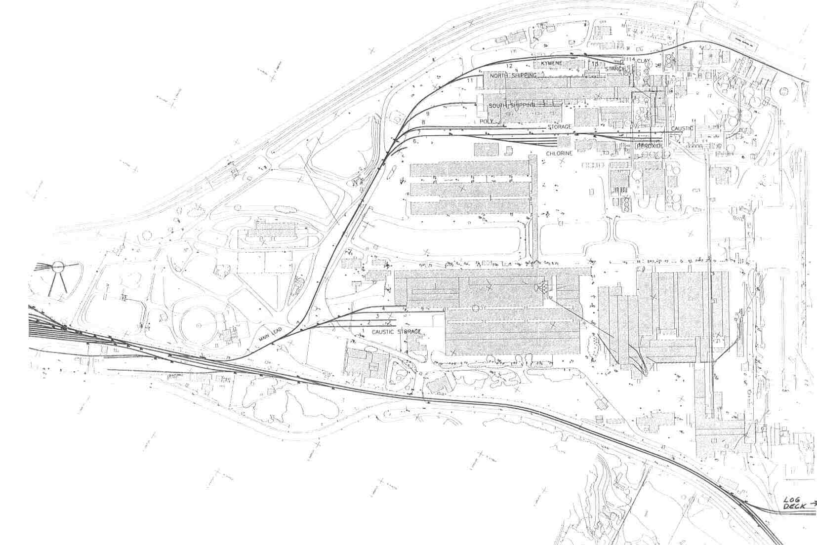
This map from Jim Davis shows the location of tracks around the mill circa 1970. Below are he and Jim Morefield's comments on the map: The map shows all tracks from #1 into the lumber shed to #15. The track leading to Tracks 12-15 is the North Lead, and Track 6 is the South Lead.
Track 15 was for salt cake or sodium sulphate unloading. Tracks 13 and 14 are labeled as starch and clay on the 2000 map, and we think that would have been the uses of those tracks in 1970 as well. Track 12 is labeled "kymene" on the 2000 map. We don't know what that is.
Tracks 10 and 11 are for paper shipping. The Poly Track is for unloading plastic granules. Track 6 proper (the very end of the South Lead) is for caustic (sodium hydroxide solution) unloading. The Plyboard Track extended into the plywood and oriented strand board mill.
All four lumber tracks (Tracks 1-4) went inside the lumber storage buildings. Added 10/31/03 |
|
|
|
|
Click to Enlarge
|
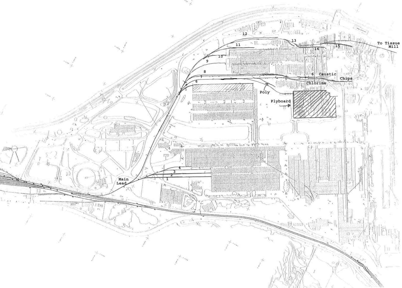
The second map shows the differences in 2000. Here are Jim Davis' and Jim Morefield's comments regarding 30 years of changes. Note the many changes besides the alignment: Track 15 was eliminated Tracks 13 & 14 were repositioned Track 12 was flip flopped from a siding to the lead. Track 11 is now enclosed Track 10 was removed. Tracks 7 and 8 were shorted. Originally they both used to cut back into the south lead (Track 6) The Chlorine tracks were added and the Poly unloading was moved to Track 8. The old chlorine tracks are now used for peroxide and sodium hydroxide unloading. The Chip track, the Plyboard track and the entire plywood mill are gone. Track 5 and the lumber shed are both gone now. All four lumber tracks (Tracks 1-4) used to go inside the lumber storage buildings on the south side of the plant. Track 1 and 2 are now used for caustic (sodium hydroxide) tank car storage. Added 11/9/03 |